Water and Electricity DO Mix on Mars
I'm very tired from just having completed five EVAs over five consecutive days (July 19-23). One of these EVAs was to Gemini Hills to find gypsum, and the other four were all related to to my second geophysical research project. Recall from a previous post that I successfully installed a seismic station for my first geophysical project. This new experiment is even more ambitious. I'm trying to find groundwater using the time domain electromagnetic (TDEM) method.
Before diving into this experiment, I'll share my next video blog entry #6 with you. It's all about water usage at FMARS:
In a nutshell, the TDEM geoelectrical survey technique takes advantage of Faraday's Law to discern conductivity changes in the subsurface. This same principle is what allows electric motors and transformers to function.
 A TDEM survey works like this. An electric current is passed through a large square loop of wire laid horizontally on the ground. This in turn generates a magnetic field perpendicular to the loop. When the electric current in the transmitter loop wire is suddenly turned off, the magnetic field surrounding the wire changes. Changing magnetic fields generate electric fields. This induces an eddy current in the surrounding rock. The ground's natural resistivity causes this current to decay immediately, and this current change it in turn induces more current to flow at greater depth (and so on). In the TDEM method, a receiving coil of wire then picks up this secondary electric field emitted from the rock. From this, we can discern the ground's electrical resistivity (and its inverse, conductivity) at successfully greater depths.
Electromagnetic exploration for groundwater on Mars has been recognized as the most promising way to find that precious aqueous resource. Bob Grimm and colleagues are developing a TDEM sounder for use on a Mars lander. You can watch a video of it being tested here. A TDEM instrument was also a payload on the cancelled Russian Mars 94 mission, which later became the ill-fated Mars 96 mission. The company which developed the small, low power TDEM equipment for the Russian Mars mission has since commercialized the instrument as the TEM-FAST, which has been previously tested on Devon Island.
I would have liked to work with either of these instruments meant for Mars application, but neither was available to me this summer, so I went looking for a more conventional terrestrial one. The industry standard TDEM systems come from Geonics Limited, a Canadian company. I called them up and asked if I could borrow a PROTEM reciever and TEM47 transmitter. Thankfully, they agreed.
It wasn't easy getting this equipment to Devon Island. For starters it came in two large, heavy boxes totaling nearly 100 kg (220 lb). This is considered lightweight by terrestrial standards, but it's much too heavy and bulky for Mars application. However, I managed to get it to FMARS without too many problems. Thanks to The Mars Society for footing the hefty shipping bill. Originally, I was optimistic that I could complete the field project in about two days. It took four.
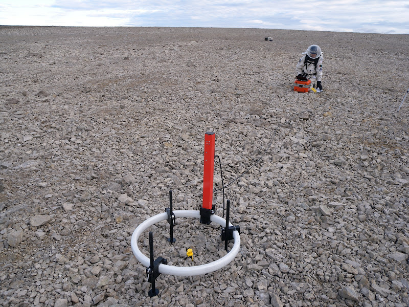
The plan was to carry out the TDEM survey on the Haynes Ridge near the FMARS Hab along the same profile as a 2001 seismic refraction experiment carriedout by Pletser, et al. (2009). That way, I can combine the seismic and electromagnetic information to get a more complete picture on the subusurface structure. Pletser's work had been criticized, so I wanted to see what more we could learn about the area. With the available 40 × 40 m loop, this meant we needed at least three stations spanning 120 meters centered on the 2001 seismic refraction line. The image below shows the planned location of the survey in relation to FMARS after we'd established the corners of the first loop.

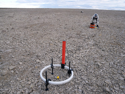
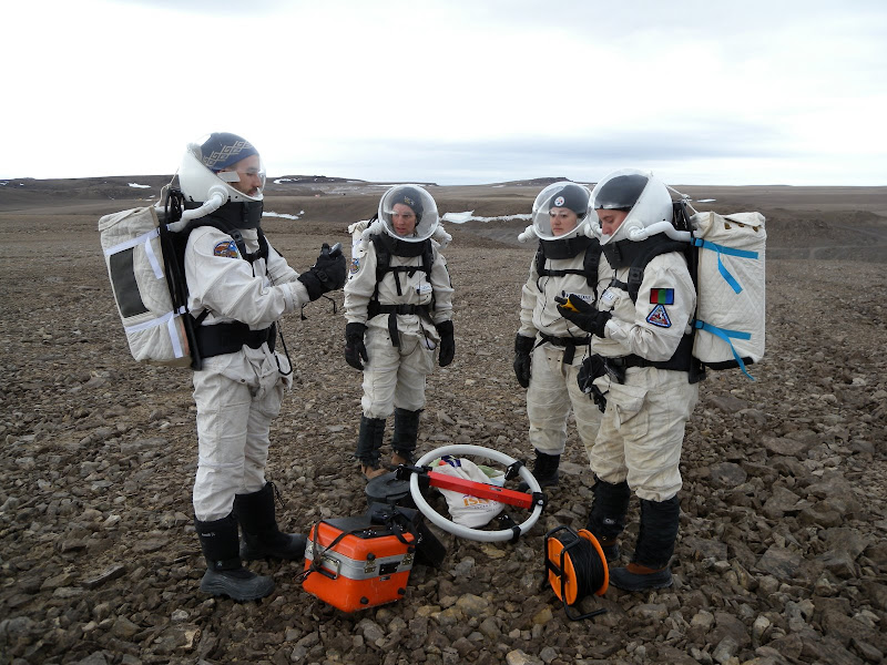
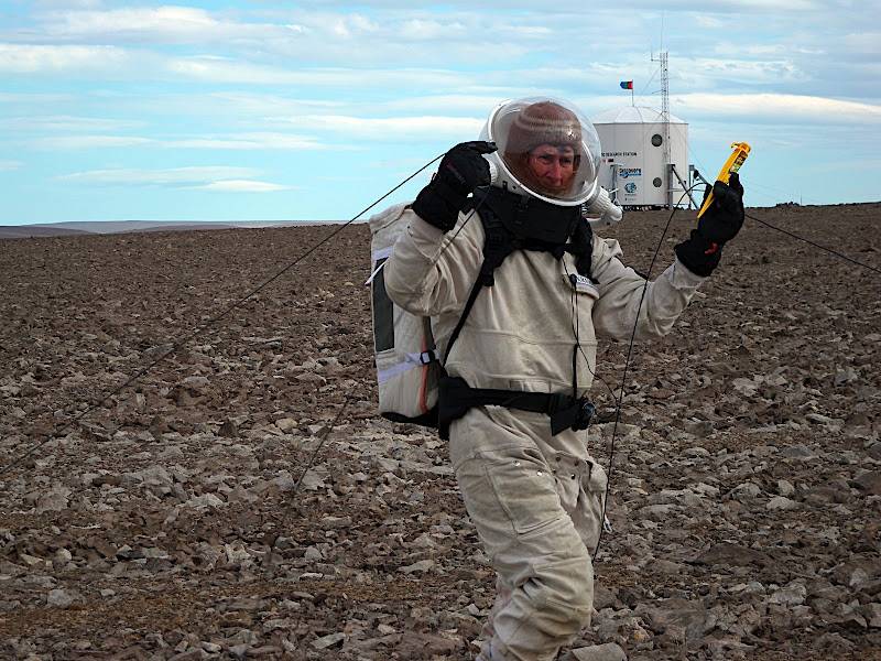
We started the project with EVA 8, which was the first FMARS 2009 EVA consisting of four in-sim people. Initially, we had to establish the 120-meter long profile end points using the GPS waypoints I had programmed prior to the EVA. Then, we laid out a line using surveying tapes to the midpoint and marked it with a rock pile. We measured out half the length of each side (~20 meters) at approximate right angles from the profile line and laid out the cable. Thankfully, on the day prior, Kristine and I had marked all of the corners on the wire with duct tape, so this made identifying them in the field easy. After some adjusting, we were satisfied that the loop was pretty close to square.
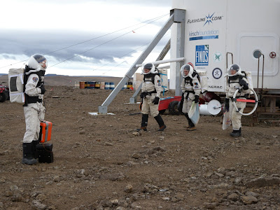


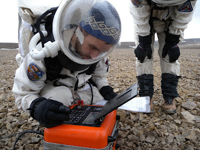
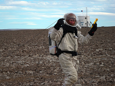
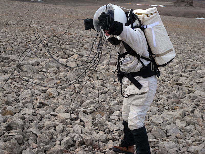
It rained during almost the entire EVA, and this slowed us down considerably. The combination of wind and sharp protruding dolomite rocks kept blowing and snagging the measuring tape and wire. We were always having to untangle them or get them unstuck from the rocks. Without 8 hands, this process would have taken much longer than the nearly 3 hours we consumed laying out the loop. The rain made it nearly impossible to see the PROTEM screen, but I did manage to take one reading before deciding to end the EVA.


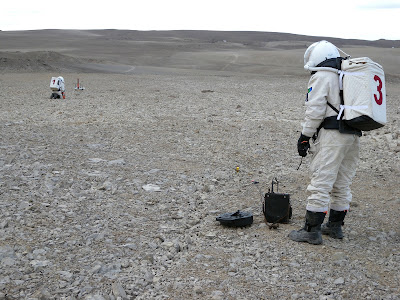
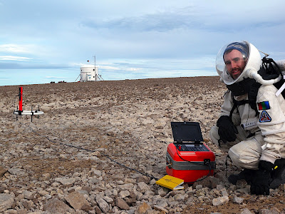
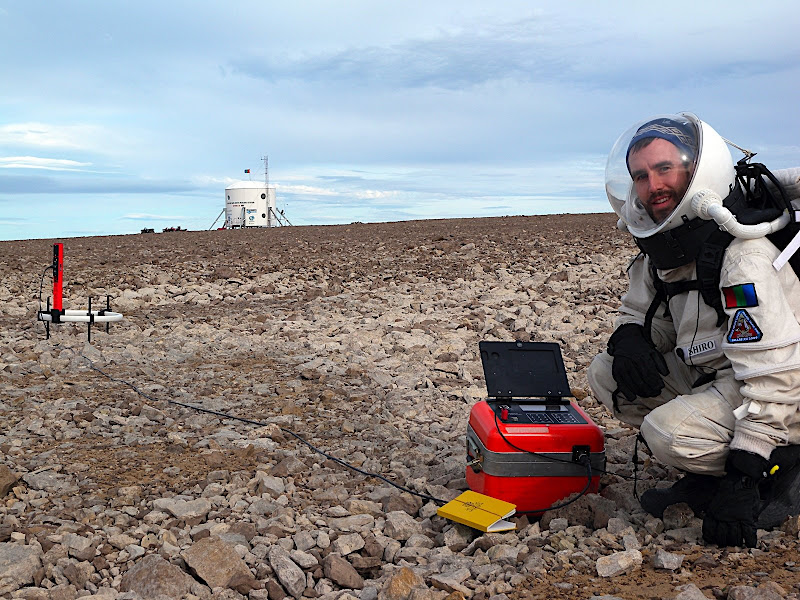
With the first loop already deployed, I expected the next EVA (#10) to go quickly. However, little setbacks added up to the lengthy EVA duration of nearly 4 hours, despite being efficient throughout the process. Starting with this EVA, we hauled the heavy Geonics equipment to the site using an ATV rather than hand carrying it like we’d done in EVA 8. As a precaution, I made sure the ATV was driven back near the Hab prior to taking any measurements. We also turned off our radios during the actual measurement taking during this and all subsequent EVAs. I took a full suite of measurements at three receiver locations for this loop.

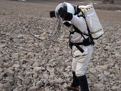
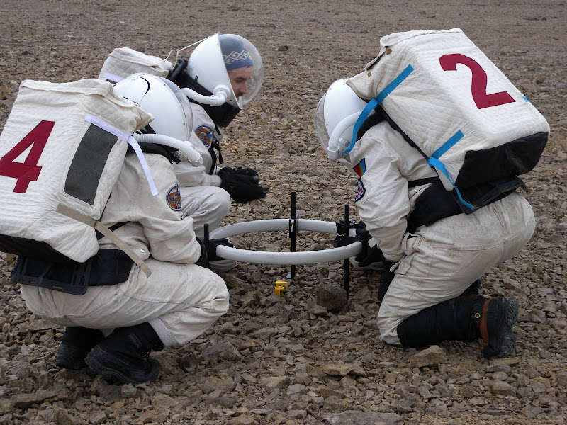
The next day, I decided to press ahead with the project with EVA 11. I managed to find two people to help me (in sim, of course) move the big 40 meter loop from its first location to the second, preserving a common side between the two loops. To accomplish this "loop flip", we first laid out a surveying tape from the center point of the first loop along the azimuth of the profile to one of the rock piles we had made during EVA 8. Then, we removed the stakes from the far corners of the first loop and made sure the line was secured well to the stakes at the other two. Next, two people picked up the wire at the corners, and a third person picked up the cable in the center of that side. We then walked out the line, trying to keep it taught to avoid catching it on rocks. However, the trailing part of the cable on each leg inevitably got stuck on rocks, so it took about an hour to get the cable moved to the new location. Not too bad for three people in bulky space suits. I spent the remaining 3 hours taking readings at three locations in and around this loop.

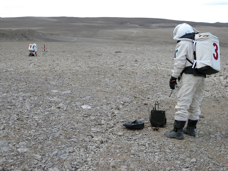
 Although I was tired from four consecutive EVAs, we needed to finish the project to free up people for other mission EVA goals. The fourth and final EVA (#12) took place yesterday in winds so strong I could barely stand up. Flipping the big loop of wire from its second to its third position took about an hour again - despite the winds blowing it around all over the place and getting it tangled. The measurement-taking part of the EVA also lasted nearly 3 hours like the previous EVA. Midway through the second of three sets of readings, a BBC helicopter flew overhead, and the HMP Hummer drove next to the loop, with its new simulated lunar airlock-to-spacesuit flapping in the breeze behind it. I'm sure this made for some great video footage with us astronauts working in the area as the simulated lunar rover drove through, but it wreaked havoc on my measurements. I had to re-do them twice before I was satisfied I had enough good readings.
In total, my crew mates and I spent a total of 15 hours and 40 minutes over the course of the four EVAs to complete this experiment. In terms of total man-hours, that is over 46 hours. The figure below shows my foot path measured by GPS during EVAs 10 (yellow), 11 (blue), and 12 (red). The square shape of each loop is clearly visible. The Hab is about 250 meters from the survey area, and the crater rim is about 100 meters away.

We know Mars has had water in abundance in the past and still has it locked away in the icecaps and permafrost today. Finding subsurface groundwater, even if it's a few kilometers deep, would be an important discovery both scientifically and practically. Water is the necessary ingredient for most life as we know it, so places with water are the natural locations to look for extant or extinct martian organisms. Furthermore, people need water to live on Mars too, so if we can find sources that we can drill, human settlement becomes that much easier.
With the help of crew mates, I have completed the FMARS 2009 time domain electromagnetic experiment to search for groundwater near the rim of the Haughton Crater on Haynes Ridge near the FMARS Hab.
I am very grateful to Geonics Limited for loaning the TDEM equipment for the duration of the FMARS expedition. The Geonics equipment was definitely not designed with astronaut use in mind, but we have learned some valuable lessons about how to make a survey like this more efficient for extraterrestrial use. To help mitigate the reduced mobility and dexterity of the spacesuits, as many aspects of the operation should be automated as possible. Laying out a large loop by hand is probably not a practical or efficient use of astronaut time, so automating that process with robotics or by making the loop mobile on a rover should be high priorities. It is difficult to connect some of the cables into the units, so more clearance on the connectors and perhaps push-on connectors would be easier. Likewise, all receiver configuration should be done before going to the field so that all the operator has to do is push a button to take a measurement. In general, every effort should be made to make the equipment more user-friendly and plug-in-play. The screen should ideally be made more visible, perhaps even integrated into a heads up display inside the spacesuit helmets.
You can learn more about the electromagnetic survey from my preliminary FMARS Science Report.
Before diving into this experiment, I'll share my next video blog entry #6 with you. It's all about water usage at FMARS:
In a nutshell, the TDEM geoelectrical survey technique takes advantage of Faraday's Law to discern conductivity changes in the subsurface. This same principle is what allows electric motors and transformers to function.
A TDEM survey works like this. An electric current is passed through a large square loop of wire laid horizontally on the ground. This in turn generates a magnetic field perpendicular to the loop. When the electric current in the transmitter loop wire is suddenly turned off, the magnetic field surrounding the wire changes. Changing magnetic fields generate electric fields. This induces an eddy current in the surrounding rock. The ground's natural resistivity causes this current to decay immediately, and this current change it in turn induces more current to flow at greater depth (and so on). In the TDEM method, a receiving coil of wire then picks up this secondary electric field emitted from the rock. From this, we can discern the ground's electrical resistivity (and its inverse, conductivity) at successfully greater depths. Electromagnetic exploration for groundwater on Mars has been recognized as the most promising way to find that precious aqueous resource. Bob Grimm and colleagues are developing a TDEM sounder for use on a Mars lander. You can watch a video of it being tested here. A TDEM instrument was also a payload on the cancelled Russian Mars 94 mission, which later became the ill-fated Mars 96 mission. The company which developed the small, low power TDEM equipment for the Russian Mars mission has since commercialized the instrument as the TEM-FAST, which has been previously tested on Devon Island.
I would have liked to work with either of these instruments meant for Mars application, but neither was available to me this summer, so I went looking for a more conventional terrestrial one. The industry standard TDEM systems come from Geonics Limited, a Canadian company. I called them up and asked if I could borrow a PROTEM reciever and TEM47 transmitter. Thankfully, they agreed.
It wasn't easy getting this equipment to Devon Island. For starters it came in two large, heavy boxes totaling nearly 100 kg (220 lb). This is considered lightweight by terrestrial standards, but it's much too heavy and bulky for Mars application. However, I managed to get it to FMARS without too many problems. Thanks to The Mars Society for footing the hefty shipping bill. Originally, I was optimistic that I could complete the field project in about two days. It took four.
The plan was to carry out the TDEM survey on the Haynes Ridge near the FMARS Hab along the same profile as a 2001 seismic refraction experiment carriedout by Pletser, et al. (2009). That way, I can combine the seismic and electromagnetic information to get a more complete picture on the subusurface structure. Pletser's work had been criticized, so I wanted to see what more we could learn about the area. With the available 40 × 40 m loop, this meant we needed at least three stations spanning 120 meters centered on the 2001 seismic refraction line. The image below shows the planned location of the survey in relation to FMARS after we'd established the corners of the first loop.

We started the project with EVA 8, which was the first FMARS 2009 EVA consisting of four in-sim people. Initially, we had to establish the 120-meter long profile end points using the GPS waypoints I had programmed prior to the EVA. Then, we laid out a line using surveying tapes to the midpoint and marked it with a rock pile. We measured out half the length of each side (~20 meters) at approximate right angles from the profile line and laid out the cable. Thankfully, on the day prior, Kristine and I had marked all of the corners on the wire with duct tape, so this made identifying them in the field easy. After some adjusting, we were satisfied that the loop was pretty close to square.

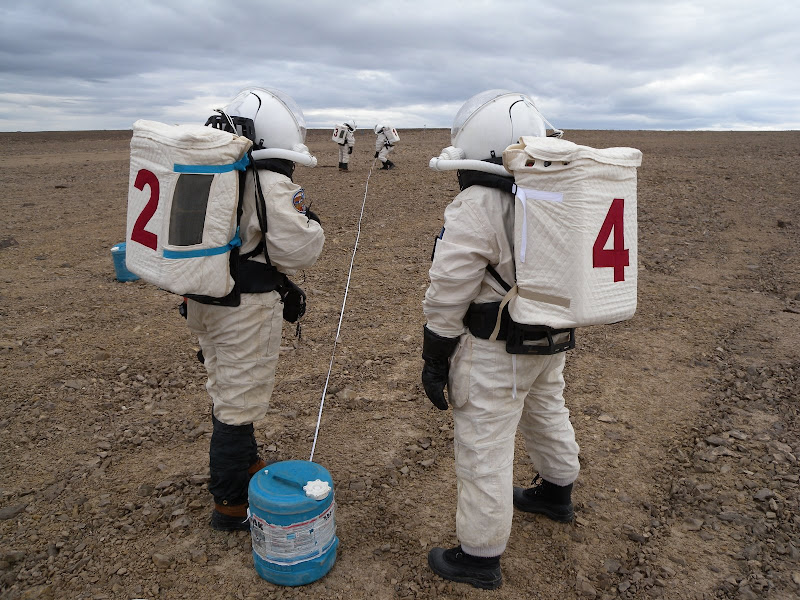
It rained during almost the entire EVA, and this slowed us down considerably. The combination of wind and sharp protruding dolomite rocks kept blowing and snagging the measuring tape and wire. We were always having to untangle them or get them unstuck from the rocks. Without 8 hands, this process would have taken much longer than the nearly 3 hours we consumed laying out the loop. The rain made it nearly impossible to see the PROTEM screen, but I did manage to take one reading before deciding to end the EVA.
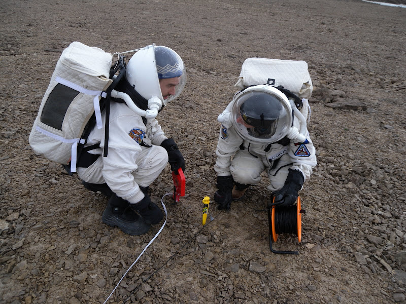

With the first loop already deployed, I expected the next EVA (#10) to go quickly. However, little setbacks added up to the lengthy EVA duration of nearly 4 hours, despite being efficient throughout the process. Starting with this EVA, we hauled the heavy Geonics equipment to the site using an ATV rather than hand carrying it like we’d done in EVA 8. As a precaution, I made sure the ATV was driven back near the Hab prior to taking any measurements. We also turned off our radios during the actual measurement taking during this and all subsequent EVAs. I took a full suite of measurements at three receiver locations for this loop.

The next day, I decided to press ahead with the project with EVA 11. I managed to find two people to help me (in sim, of course) move the big 40 meter loop from its first location to the second, preserving a common side between the two loops. To accomplish this "loop flip", we first laid out a surveying tape from the center point of the first loop along the azimuth of the profile to one of the rock piles we had made during EVA 8. Then, we removed the stakes from the far corners of the first loop and made sure the line was secured well to the stakes at the other two. Next, two people picked up the wire at the corners, and a third person picked up the cable in the center of that side. We then walked out the line, trying to keep it taught to avoid catching it on rocks. However, the trailing part of the cable on each leg inevitably got stuck on rocks, so it took about an hour to get the cable moved to the new location. Not too bad for three people in bulky space suits. I spent the remaining 3 hours taking readings at three locations in and around this loop.

 Although I was tired from four consecutive EVAs, we needed to finish the project to free up people for other mission EVA goals. The fourth and final EVA (#12) took place yesterday in winds so strong I could barely stand up. Flipping the big loop of wire from its second to its third position took about an hour again - despite the winds blowing it around all over the place and getting it tangled. The measurement-taking part of the EVA also lasted nearly 3 hours like the previous EVA. Midway through the second of three sets of readings, a BBC helicopter flew overhead, and the HMP Hummer drove next to the loop, with its new simulated lunar airlock-to-spacesuit flapping in the breeze behind it. I'm sure this made for some great video footage with us astronauts working in the area as the simulated lunar rover drove through, but it wreaked havoc on my measurements. I had to re-do them twice before I was satisfied I had enough good readings.
 In total, my crew mates and I spent a total of 15 hours and 40 minutes over the course of the four EVAs to complete this experiment. In terms of total man-hours, that is over 46 hours. The figure below shows my foot path measured by GPS during EVAs 10 (yellow), 11 (blue), and 12 (red). The square shape of each loop is clearly visible. The Hab is about 250 meters from the survey area, and the crater rim is about 100 meters away.

We know Mars has had water in abundance in the past and still has it locked away in the icecaps and permafrost today. Finding subsurface groundwater, even if it's a few kilometers deep, would be an important discovery both scientifically and practically. Water is the necessary ingredient for most life as we know it, so places with water are the natural locations to look for extant or extinct martian organisms. Furthermore, people need water to live on Mars too, so if we can find sources that we can drill, human settlement becomes that much easier.
With the help of crew mates, I have completed the FMARS 2009 time domain electromagnetic experiment to search for groundwater near the rim of the Haughton Crater on Haynes Ridge near the FMARS Hab.
I am very grateful to Geonics Limited for loaning the TDEM equipment for the duration of the FMARS expedition. The Geonics equipment was definitely not designed with astronaut use in mind, but we have learned some valuable lessons about how to make a survey like this more efficient for extraterrestrial use. To help mitigate the reduced mobility and dexterity of the spacesuits, as many aspects of the operation should be automated as possible. Laying out a large loop by hand is probably not a practical or efficient use of astronaut time, so automating that process with robotics or by making the loop mobile on a rover should be high priorities. It is difficult to connect some of the cables into the units, so more clearance on the connectors and perhaps push-on connectors would be easier. Likewise, all receiver configuration should be done before going to the field so that all the operator has to do is push a button to take a measurement. In general, every effort should be made to make the equipment more user-friendly and plug-in-play. The screen should ideally be made more visible, perhaps even integrated into a heads up display inside the spacesuit helmets.
You can learn more about the electromagnetic survey from my preliminary FMARS Science Report.


Comments